
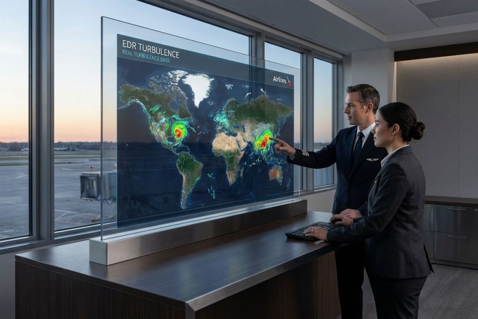
Weather tech is transforming long-haul flight safety by turning turbulence and storm risk from “best guess plus experience” into a shared, measurable, near-real-time picture that pilots and dispatchers can act on early. You get fewer surprise jolts, better-timed seatbelt and cabin decisions, and route and altitude choices that protect safety without burning unnecessary fuel.
Reading this will sharpen how modern airlines actually manage weather risk across oceanic and polar segments, where options get limited and timing matters. You’ll see how objective turbulence metrics (EDR), networked data sharing, advanced guidance products, and ops-integrated tools change decision speed and decision quality. You’ll also walk away with the one passenger behavior that still prevents the most injuries, even when every screen in the operation looks perfect.
How Do Airlines Predict Turbulence On Long-Haul Flights And How Accurate Is It?
Long-haul turbulence planning starts hours before pushback, then gets refined continuously until landing. You’re dealing with a moving target: jet streams shift, convection grows and collapses, and clear-air turbulence can appear where the sky looks calm. Predictability improves when airlines blend strategic forecast guidance with tactical, in-flight observations that confirm what is actually happening at a specific altitude and time.
Accuracy is strongest when the operation treats turbulence like a network problem, not a single-aircraft problem. Instead of relying only on forecast charts and scattered pilot reports, airlines increasingly use shared, machine-derived turbulence observations that update as other aircraft fly ahead of you. IATA’s Turbulence Aware is built around this idea: reduce time lag, reduce subjectivity, and give crews and dispatchers a common picture they can trust when deciding whether to climb, descend, slow down, or reroute.
Long-haul flying rewards early decisions. A ten-minute delay in reacting can mean a poor option set later, especially when you are crossing oceanic tracks, operating under ETOPS considerations, or working around constrained airspace and altitude blocks. When turbulence intelligence arrives in near-real time, dispatch can coordinate with the flight deck earlier, cabin leaders can manage service windows more safely, and the airline avoids repeated altitude “hunting” that increases workload and fuel burn.
Scale matters for prediction quality. In 2023, IATA reported that Turbulence Aware generated over 380 million turbulence observations, and participation has included more than 2,000 aircraft providing data daily across 21 airlines at that time. That volume changes the practical usefulness of turbulence mapping on long routes, since you gain more altitude coverage and more frequent observations along high-density corridors, not just a handful of isolated reports.
Accuracy still has limits. Turbulence is not a single phenomenon, and not all types behave the same way in models. A responsible airline uses weather tech to shrink uncertainty and tighten timing, not to promise a perfectly smooth ride. When you see the strongest safety gains, it’s because the airline uses weather tech to manage human exposure: seatbelt discipline, cabin timing, and early tactical route decisions.
What Is EDR Turbulence Data And Why Are Airlines Moving Beyond Pilot Reports?
EDR, or Eddy Dissipation Rate, gives you an objective, aircraft-independent way to quantify turbulence intensity. Pilot reports still matter for operational awareness, yet they are inherently subjective: what feels “moderate” in one aircraft type, weight, or seat location may feel different in another. EDR helps unify the language so that an operations center can compare like with like across fleets, routes, and altitudes.
Airlines moved toward EDR because it supports consistent decision thresholds. Dispatchers need a common yardstick when coordinating across a mixed fleet, and long-haul fleets are rarely uniform. When turbulence is expressed on an objective scale, it becomes easier to set operational triggers: when to brief the cabin, when to adjust service timing, when to request altitude changes, and when to accept a longer reroute because injury risk rises.
EDR also improves post-flight learning. When you can tie an event to a time, latitude/longitude, and flight level with a consistent intensity metric, you can measure whether the forecast guidance undercalled or overcalled the hazard. Over time, that improves how the airline tunes its decision support tools, trains crews on interpretation, and adjusts standard operating procedures around weather avoidance.
Industry sources also note that EDR is used as the official ICAO and WMO metric for atmospheric turbulence intensity. That matters because long-haul flying is global. When your operation crosses multiple FIRs and coordination points, standardization reduces translation errors, speeds coordination, and supports shared situational awareness when multiple airlines are viewing the same turbulence layer in their planning tools.
One operational detail tends to surprise non-aviation readers: “better turbulence data” can reduce unnecessary conservatism. When the only information available is vague or delayed, crews often respond by keeping the seatbelt sign on longer and making extra altitude changes. With better EDR-based awareness, you can target mitigation where it actually reduces risk, rather than applying broad restrictions that create fatigue, discomfort, and inefficiency.
Can Cockpit Weather Radar See All Dangerous Turbulence Including Clear-Air Turbulence?
No, cockpit weather radar cannot “see” all dangerous turbulence, and clear-air turbulence is the classic gap. Onboard radar is excellent for depicting precipitation and convective structure, which is vital for avoiding thunderstorms, hail, and the worst convective hazards. Clear-air turbulence can occur with little or no moisture signature, so it may not appear on the radar display even when it is strong enough to injure an unbelted passenger or a standing cabin crewmember.
That limitation drives the layered strategy used on long-haul flights. You want radar for convective avoidance, satellite and ground-based networks for broader weather awareness, and turbulence guidance products plus in-situ observations for the invisible risks at cruise. Airbus has been explicit that onboard weather radar detects water droplets, which is why clear-air turbulence at cruise may not show up even when it’s present.
Modern radar capabilities can still shift safety outcomes. Improved automation, better display logic, and optional functions on some fleets support earlier deviation decisions and clearer margins around convective weather. On a long-haul sector, that earlier decision is not about comfort, it is about keeping options open: routing, alternates, fuel, and altitude strategy all get easier when you decide before the corridor narrows.
The practical takeaway is simple: when a crew says “radar is clean,” it does not mean “turbulence-free.” It means “no significant precipitation returns in the scan.” That distinction is one reason airlines invest in turbulence data sharing platforms and advanced turbulence guidance, then integrate those outputs into the same tools pilots and dispatchers already use.
What Real-Time Weather Tools Do Dispatchers And Pilots Use To Reroute Long-Haul Flights Safely?
On a long-haul operation, the most useful weather tech is the tech that stays in the workflow. Dispatchers and flight planners work inside mission-critical applications that combine flight planning, fuel, alternates, airspace constraints, and weather layers. Pilots work inside flight deck weather and briefing tools and, depending on connectivity and aircraft equipage, may receive uplinked updates that support tactical decisions.
Airlines typically blend three categories of inputs: forecast guidance, real-time observation feeds, and integrated decision displays. Forecast guidance covers convection, winds and temperatures, icing potential, and turbulence probabilities by altitude and time. Observation feeds include aircraft-derived turbulence observations, pilot reports, lightning and radar composites, and airport weather. Integration is the difference-maker: it reduces cross-check time and reduces misalignment between what dispatch sees and what the cockpit sees.
IATA’s Turbulence Aware is designed to provide mapped turbulence events that are shared across participating airlines. The value is not only the data itself, it is the operational packaging: time, location, altitude, and an objective measure that can be displayed in planning and in-flight tools. That supports quicker, cleaner decisions when a flight needs to request a different level, accept a reroute, or change timing for cabin movement.
Integration partnerships matter here. IATA announced expansion of Turbulence Aware data transmission into industry tools used widely in North America through The Weather Company’s aviation solutions. The goal is straightforward: put real-time EDR-based turbulence observations inside the same applications crews and dispatchers already rely on, reducing the “multiple screens” problem that slows response when weather is active.
On long-haul flights, real-time tools also support smarter tradeoffs. Reroutes can add track miles, increase fuel burn, shift arrival times, and alter alternate requirements. When you can see where turbulence is actually occurring by altitude band, you can choose the least disruptive mitigation that still protects the cabin. That is where safety and operational performance align.
How Is AI Improving Turbulence Nowcasting And Short-Horizon Forecasts For Aviation?
AI is improving aviation turbulence guidance in a practical way: better short-horizon updates, better blending of model diagnostics, and better use of fresh observations to tune what the guidance is saying right now. Turbulence is time-sensitive. A chart that was accurate three hours ago can mislead you at top of climb or mid-ocean, where altitude changes are harder to coordinate and convection can grow faster than expected.
The FAA has described Graphical Turbulence Guidance products and concepts that include rapid updates for tactical use. One concept referenced is nowcasting that updates frequently, giving dispatch and crews a closer-to-current picture compared with slower-update forecast products. When these tools refresh often, you can make smaller, earlier adjustments, which reduces cabin exposure and reduces repeated maneuvering.
NCAR’s GTG descriptions highlight how modern turbulence guidance combines many diagnostics from numerical weather prediction and optimizes how they are weighted based on agreement with observations. That optimization step is where “AI-like” behavior becomes operationally valuable: the system can learn which signals are performing better under current conditions, then adjust how it blends them. You get guidance that tracks reality more tightly, not because one model is perfect, but because the tool adapts to what aircraft and other observations are reporting.
IATA has also pointed to near-time prediction as the next step, using Turbulence Aware data with AI tools to produce better forward-looking turbulence awareness ahead of the aircraft. That direction matters most on long routes, where crews and dispatch want a confident call on whether a rough band will persist long enough to justify a major lateral reroute, or whether a small altitude change after coordination will solve it.
AI does not remove the need for operational judgment. It changes what judgment can be based on. When the operation has objective EDR feeds, optimized guidance products, and near-real-time updates, the crew’s decision becomes less about guessing and more about managing exposure windows: when people move, when service happens, when the seatbelt sign stays on, and when deviations are worth the cost.
Do Consumer Turbulence Forecast Apps Actually Work Or Mislead Passengers?
Consumer turbulence “scores” create a problem: they compress a complex, altitude-dependent hazard into a single number that looks precise and feels personal. Airline operations do not run on a single score. They run on layered guidance, real-time updates, and coordination between dispatch and cockpit, then they apply cabin safety procedures that assume turbulence can still occur with limited warning.
Many consumer tools pull from publicly available model outputs and present them without the operational guardrails airlines use. Turbulence changes quickly, and the most meaningful question is not “Will it be bumpy?” but “At what altitude, at what time, and how much exposure risk exists when people are unrestrained?” A consumer score rarely answers that in a way that supports safe behavior, so it tends to drive anxiety rather than better decisions.
Community moderation patterns reinforce that concern. In the fear-of-flying community on Reddit, moderators have explicitly discouraged turbulence forecasting apps and have cited known inaccuracies, removing posts that rely on those tools. That aligns with what airline crews see operationally: consumer forecasts can be directionally interesting, yet they are not a reliable predictor of the moment when an aircraft encounters a short-lived patch at cruise.
For passengers, the more useful focus is behavior under uncertainty. Airline weather tech reduces surprise and improves timing, yet it does not eliminate sudden changes. When passengers outsource peace of mind to a consumer score, they often trade a manageable risk for a constant worry. A better outcome comes from adopting one simple habit that aligns with how airlines actually manage turbulence injuries.
What Is The Number One Thing Passengers Can Do To Reduce Injuries During Turbulence?
Keep the seat belt buckled while seated, even when the seatbelt sign is off. That single behavior directly targets the most common injury mechanism: an unexpected vertical acceleration that lifts an unrestrained person into the ceiling or into hard structure, or throws a standing person off balance. Turbulence can occur in clear air, and it can occur faster than a cabin announcement can reach every row.
The FAA’s passenger-facing turbulence safety guidance emphasizes seat belt use as the primary protection step. The same FAA page also presents serious-injury counts tied to turbulence events, showing that injuries still occur and that crew members are often the ones hurt because their job requires movement during phases when turbulence can develop. When you stay belted, you reduce injury probability in the exact scenario weather tech cannot fully prevent: the sudden, brief, unexpected jolt.
Airlines have also adjusted procedures to reduce cabin exposure. Reporting has described Southwest planning to end cabin service earlier on some flights to reduce injury risk as the aircraft transitions toward arrival phases where turbulence can be more common. That procedural change sits alongside weather tech improvements: better data helps, yet the operation still acts as if turbulence can arrive at a bad moment, so it reduces the time people are standing.
If long-haul safety is the goal, it helps to treat seat belt discipline as part of the system, not a passenger preference. You are not only protecting personal safety. You are also reducing the chance of a medical diversion or operational disruption that can affect everyone onboard.
How Do Airlines Use Weather Tech To Improve Long-Haul Safety?
- Blend forecasts with real-time aircraft turbulence data (EDR)
- Share turbulence reports across airlines to cut time lag
- Reroute or change altitude early, time cabin movement safely
Put Weather Tech To Work The Way The Pros Do
Long-haul safety improves when weather intelligence becomes shared, measurable, and fast enough to change decisions before the cabin gets exposed. You see that shift in objective EDR reporting, platforms that pool turbulence observations across airlines, and guidance products that update frequently for tactical use. You also see it in tighter integration, putting turbulence layers inside the same tools pilots and dispatchers already trust, reducing confusion and delay. Consumer turbulence scores rarely help you behave safely, since they oversimplify a time-and-altitude dependent hazard that can change quickly. Keep the seat belt buckled while seated and treat announcements and seatbelt signs as risk controls, not comfort settings, and the benefits of better weather tech translate into real injury prevention.
References
- IATA – Turbulence Aware Platform: https://www.iata.org/en/services/data/safety/turbulence-platform/
- IATA Airlines Magazine – Enhanced Turbulence Data (Feb 26, 2024): https://airlines.iata.org/2024/02/26/enhanced-turbulence-data
- IATA Press Release – IATA & The Weather Company to Provide Enhanced Turbulence-Related Weather Data (Feb 21, 2024): https://www.iata.org/en/pressroom/2024-releases/2024-02-21-01/
- SKYbrary – Eddy Dissipation Rate (EDR): https://skybrary.aero/articles/eddy-dissipation-rate-edr
- Airbus – Severe Weather Hazards: Anticipate And Avoid (Jul 2024): https://www.airbus.com/en/newsroom/stories/2024-07-severe-weather-hazards-the-best-is-to-anticipate-and-avoid
- FAA NextGen – Turbulence (AWRP): https://www.faa.gov/nextgen/programs/weather/awrp/turbulence
- NCAR RAL – Graphical Turbulence Guidance (GTG-3): https://ral.ucar.edu/solutions/products/graphical-turbulence-product-gtg-3
- IATA Opinion – Navigating Turbulent Skies With Certainty: https://www.iata.org/en/pressroom/opinions/navigating-turbulent-skies-with-certainty/
- FAA Travelers – Turbulence: Staying Safe: https://www.faa.gov/travelers/fly_safe/turbulence
- AP News – Southwest To End Cabin Service Earlier To Reduce Injury Risk: https://apnews.com/article/southwest-airlines-cabin-service-a2766c4de881e1467900b392789457de

Chrysilios Chrysiliou is a commercial real estate executive at RDPH Properties, Inc. with a diverse background in aviation and entrepreneurship. A former Greek Air Force Academy graduate, flight instructor, and flight school co-owner, he now leverages decades of strategic leadership to identify and develop high-value real estate opportunities.