
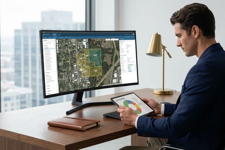
Remote sensing is changing real estate site selection by letting you screen land before you spend serious time, money, and political capital on it. You can identify buildability constraints, climate exposure, land-cover change, terrain issues, and surrounding growth patterns much earlier than traditional deal flow allowed.
If you source, evaluate, or approve sites, this gives you a faster way to cut weak parcels, sharpen underwriting, and focus fieldwork where it counts. You will see where satellite imagery, aerial photography, elevation data, soil mapping, and hazard layers fit into a modern site selection workflow, where they add real value, and where they still need surveyors, engineers, and local diligence to finish the job.
What Is Remote Sensing In Real Estate Site Selection?
Remote sensing in real estate means using data collected from satellites, aircraft, radar systems, thermal sensors, and light detection and ranging tools to evaluate land without standing on the site. In practical terms, you use imagery and geospatial layers to judge whether a parcel is physically suitable, operationally efficient, and exposed to risks that could change deal economics. That shifts early diligence from a broker package and a windshield tour to measurable screening.
For site selection, this matters because raw location data now reaches far beyond a static map pin. You can review slope, drainage patterns, vegetation cover, nearby construction, paved surfaces, access corridors, flood exposure, and heat intensity before ordering field studies. That lets you compare many candidate sites at once and reject poor fits before they consume legal, engineering, and entitlement budgets.
The bigger shift is strategic. Site selection used to lean harder on local relationships, broker memory, and manual desktop research. You still need those inputs, yet remote sensing gives you a repeatable way to score sites across a wider geography with fewer blind spots. That makes your pipeline more disciplined and your investment committee conversations more defensible.
You also gain a stronger view of change over time. A parcel is not just a static piece of land. It sits inside a growth corridor, a drainage system, a traffic network, and a climate exposure pattern. Remote sensing lets you evaluate that setting with more precision, which is why it has moved from environmental and infrastructure planning into mainstream commercial and residential site screening.
How Do Satellite Images Help Investors Choose Better Development Sites?
Satellite imagery helps you spot what spreadsheets and offering memoranda often miss. You can see whether surrounding land is actually developing, whether nearby industrial activity is expanding, whether stormwater features cut through the tract, and whether road access looks functional in the real world rather than clean on a parcel map. That visual evidence strengthens early underwriting before consultants start billing.
At the broad screening stage, multispectral satellite imagery is useful for identifying land cover, water bodies, disturbed ground, vegetation stress, and the pace of development around the site. This matters when you are screening logistics corridors, suburban expansion areas, master-planned growth zones, or infill neighborhoods where physical change drives future value. You are not just buying a parcel. You are buying into the pattern around it.
Higher-resolution aerial imagery adds another layer of decision value. You can inspect curb cuts, truck circulation, grading activity, retention ponds, tree cover, adjacent uses, nearby rail lines, and built-form compatibility with much more detail. That is especially useful in retail, industrial, build-to-rent, and multifamily selection, where access friction and surrounding property conditions can change lease-up and exit outcomes.
Satellite imagery also compresses comparison time. Instead of visiting ten sites to eliminate eight, you can narrow the list before the first trip. Your team can prioritize the parcels that show real operational promise and visible momentum, then allocate field visits to the finalists. That sequence saves time, but more importantly, it saves organizational attention.
Can Remote Sensing Really Predict Flood, Heat, Or Climate Risk For A Property?
Yes, remote sensing can flag flood, heat, and climate-related exposure early enough to change site strategy. It will not replace engineering analysis or insurance review, yet it gives you a screening layer that catches risk before it becomes a sunk cost. For real estate operators, that is often the difference between disciplined diligence and expensive surprise.
Flood screening benefits from combining elevation data, water flow patterns, coastal inundation tools, and public hazard mapping. If a parcel sits in low-lying terrain, near tidal influence, along visible drainage swales, or close to flood-prone infrastructure, remote sensing usually surfaces those signals quickly. You can then decide whether the site deserves a deeper resilience review or should leave the pipeline altogether.
Heat risk is moving up the priority list, particularly in dense urban markets and fast-growth Sun Belt metros. Surface temperature patterns, tree-canopy coverage, impervious cover, and neighborhood heat burden affect livability, cooling costs, tenant experience, and municipal resilience planning. When you combine heat layers with aerial imagery and land-cover data, you get a clearer read on whether a site will need more shade, stormwater investment, open-space planning, or design adjustments to remain competitive.
Climate screening also helps with portfolio logic, not just one-off parcels. If you evaluate coastal multifamily, logistics hubs, or large land positions, you need a way to rank exposure across many assets and submarkets. Remote sensing supports that ranking. The limit is simple: it screens risk well, yet it does not certify a site as safe. Once the parcel survives screening, civil engineers, surveyors, insurance specialists, and local records still decide whether the deal closes on sound terms.
What Data Layers Matter Most When Screening Land For Development?
The most useful data layers are elevation, slope, flood exposure, soils, land cover, heat, environmental constraints, infrastructure adjacency, and nearby land-use change. If those layers line up, you can get to a credible early-stage decision much faster. If one of them breaks the site, you avoid spending money for the privilege of discovering bad news late.
Elevation sits near the top of the list because grading cost, drainage behavior, and pad readiness can make or break a project. Light detection and ranging, often shortened to lidar after the full term has been established, gives you much stronger terrain intelligence than ordinary basemaps. Subtle changes in grade, drainage channels, and low spots often explain why one parcel is easy to develop and the parcel across the road turns into a cost problem.
Soil data is another layer many teams underuse. Soil characteristics influence drainage, bearing conditions, septic suitability, agricultural status, and the potential presence of hydric soils that may trigger additional review. If you check soils early, you can avoid the common mistake of underwriting a tract as clean greenfield land when subsurface conditions point to design changes, stormwater complications, or entitlement friction.
Land-cover and vegetation layers tell you whether the site and its surroundings are becoming more urban, staying rural, or carrying environmental features that affect development. Add hazard layers and heat mapping, and you get a stronger view of physical exposure. Add road access, nearby industrial activity, utility corridors, and surrounding development momentum, and the site starts to reveal whether it fits your use type, your timing, and your capital plan.
The strongest screening models do not rely on one map. They combine several layers into a suitability score tied to the project’s priorities. A distribution site may weight slope, truck access, flood risk, and pad-readiness. A multifamily site may place more weight on heat burden, nearby tree cover, neighborhood change, drainage, and surrounding uses. That is where remote sensing becomes an operating advantage rather than a visual extra.
How Accurate Is Remote Sensing Compared With Site Visits, Surveys, Or Parcel Maps?
Remote sensing is accurate enough to improve screening, ranking, and early decision-making, yet it is not survey-grade proof of legal or engineering reality. You should treat it as a filter that helps you know where to spend diligence dollars, not as a substitute for title work, boundary surveys, geotechnical review, or municipal verification. That distinction protects you from one of the most common errors in digital site selection: trusting sharp images more than the underlying legal facts.
Accuracy depends on the source and on the question you are asking. Satellite imagery can be excellent for land-cover change, water presence, access review, and broad physical pattern analysis. Aerial photography improves parcel-level visual interpretation. Lidar-derived elevation products improve terrain analysis. None of those data sources, on their own, establish exact legal boundaries or confirm that a mapped line matches what a surveyor would certify on the ground.
That matters because parcel overlays often look more certain than they are. Tax parcel boundaries, basemap overlays, and public map interfaces can drift from legal monuments and recorded surveys. If you are making acquisition decisions, you cannot let a clean satellite image create false confidence around setbacks, encroachments, frontage, or access rights. Remote sensing helps you ask better questions. It does not close them.
Site visits still matter for reasons imagery cannot fully capture. You need to see curb conditions, noise, odors, traffic behavior, neighboring operations, utility clues, local road wear, and the general feel of how the property functions inside its micro-market. The best workflow is not remote sensing versus fieldwork. It is remote sensing first, fieldwork second, specialist validation after that. That sequence improves speed without sacrificing discipline.
Which Remote Sensing Tools Are Actually Used In Modern Site Selection Workflows?
Modern site selection rarely runs through a single tool. You usually see a stack that combines satellite imagery, aerial photography, elevation products, soil surveys, hazard viewers, and cloud-based geospatial analysis platforms. The winning workflow is not built around one branded interface. It is built around the right data at the right stage of the decision.
For broad imagery and change detection, teams commonly use open Earth observation sources that support land-cover review, vegetation analysis, water detection, and urban growth monitoring. For higher-detail review in the United States, aerial imagery adds visible site conditions that matter to parcel-level diligence. For terrain, United States Geological Survey elevation products and lidar-derived datasets help expose slope constraints and drainage realities that flat basemaps often hide.
Soil screening tools are valuable before geotechnical work begins. Hazard viewers for coastal exposure, flood screening, and environmental conditions help you rank risk earlier in the funnel. Cloud geospatial platforms help analysts run repeatable comparisons across many sites instead of checking each tract one by one. That matters when your team is reviewing a market-wide pipeline, a regional acquisition brief, or a portfolio repositioning plan.
The practical adoption pattern is straightforward. Open data supports fast screening and directional scoring. Higher-resolution imagery and specialty layers support deeper review. Engineers, surveyors, attorneys, and local consultants then validate the shortlist. Teams that understand this sequence get more value from remote sensing than teams that chase a single all-in-one dashboard and expect it to replace diligence.
You also see growing demand for location-intelligence products that make these tools easier for non-specialists to use. Brokers, developers, retailers, and capital partners want interfaces that surface terrain, risk, and neighborhood change without forcing every decision-maker into a full geographic information system environment. That is where remote sensing is heading in real estate operations: less novelty, more embedded decision support.
What Are The Limits, Risks, And Blind Spots Of Using Remote Sensing In Real Estate?
The biggest risk is false certainty. A dense map stack can make a site feel understood long before it has been proven. Remote sensing can identify patterns, but it can miss entitlement barriers, local political resistance, utility constraints, drainage disputes, off-site improvement obligations, recorded easements, and physical conditions hidden below the surface. Those issues still kill deals.
Time lag is another blind spot. Imagery updates, hazard models, and public layers do not always refresh on the same cycle. A site may have recent grading, new access changes, demolition work, fresh construction nearby, or municipal improvements not yet visible in the data you are using. If your team does not verify update timing, you can make decisions with information that looks current and acts stale.
There is also a scale problem. Some datasets are excellent for trade-area screening and weak for parcel-specific judgment. Others are strong at parcel detail but thin on regional comparison. If you mix those scales carelessly, you can overread what the data can support. This is where experienced operators separate themselves. They know which layer answers which question and when to stop stretching a tool past its intended use.
Another blind spot is organizational. If acquisitions, development, asset management, and capital markets teams do not align on what the data means, remote sensing can create noise instead of clarity. One team may treat a flood screen as a hard stop, another may treat it as a pricing adjustment, and another may ignore it in favor of yield. You need a decision rule, not just a map library.
The strongest operators use remote sensing to reject, rank, and scope diligence. They do not use it to avoid uncomfortable facts. Once a parcel shows promise, the work gets more granular, not less. That discipline is what keeps remote sensing valuable instead of decorative.
How Should You Build Remote Sensing Into A Real Estate Site Selection Process?
You get the most value from remote sensing when you build it into the front end of your pipeline instead of treating it as an analyst side project. Start by defining the use case with precision. Retail, industrial, multifamily, self-storage, data center, and master-planned land each require a different weighting of access, terrain, risk, surrounding uses, and environmental constraints. If the objective is vague, the map stack becomes clutter.
After the use case is defined, set a screening sequence. Begin with geography, then layer in land-cover change, elevation, hazard exposure, soils, and infrastructure adjacency. Use those filters to cut the long list to a manageable set. Once the shortlist is built, review higher-resolution imagery, local parcel data, and municipal context before approving site visits. This order keeps the process efficient and keeps the team from spending executive time on parcels that fail basic physical tests.
You should also standardize what counts as a red flag, a yellow flag, and a pricing item. A tract with visible drainage issues and poor soils may be a hard stop for one product type and a discount opportunity for another. A heat-burden issue may be manageable in a logistics play with the right design, yet damaging in a lifestyle-oriented rental community. The point is not to make every site fit the same rule. The point is to make the decision logic consistent.
Reporting matters just as much as data quality. Decision-makers need clear visuals tied to business outcomes, not a stack of maps with no operational takeaway. Show the site, the key overlays, the likely cost drivers, the main risks, and the reason it advances or drops. That kind of memo turns remote sensing from a technical output into an investment tool.
Why Does Remote Sensing Matter More Now Than It Did In Traditional Site Selection?
Remote sensing matters more now because site selection has become faster, more competitive, and more exposed to physical risk than in prior cycles. You are often screening wider geographies, moving under tighter timelines, and answering tougher questions from lenders, partners, and internal committees. A process built on broker memory and scattered public records is no longer enough.
At the same time, public geospatial data has become easier to access and easier to analyze. You can now combine imagery, elevation, soils, flood indicators, and environmental layers at a speed that would have required specialized internal teams not long ago. That lowers the barrier to better screening and raises the standard for serious operators. If your competitors can eliminate weak sites faster, your margin for slow diligence disappears.
Investor expectations have changed as well. Physical risk, resilience, utility readiness, neighborhood change, and long-term operating costs are part of the deal conversation earlier than before. Remote sensing supports those conversations with visible evidence rather than broad assumptions. It does not remove uncertainty, yet it narrows it in a way that improves pricing, site ranking, and internal alignment.
This is why remote sensing is no longer a niche add-on borrowed from environmental science. It is becoming part of normal real estate decision infrastructure. If you control acquisitions, development, portfolio planning, or market expansion, it gives you a sharper first pass and a stronger basis for where to deploy expert diligence.
What Does Remote Sensing Do For Real Estate Site Selection?
- It helps you screen sites before fieldwork.
- It reveals terrain, flood, soil, heat, and land-use risks.
- It improves parcel ranking across large geographies.
- It reduces wasted diligence on weak sites.
- It supports faster, better-informed acquisition decisions.
Turn Better Site Intelligence Into Better Deals
Remote sensing gives you a sharper way to evaluate land before cost and momentum start working against you. When you combine imagery, elevation, soils, hazard screening, and surrounding development patterns, you can reject weak parcels sooner and move stronger sites into deeper diligence with more confidence. The real advantage is not that remote sensing replaces site visits, surveys, or engineers. The advantage is that it makes those expensive steps more selective, more targeted, and more useful. If you build it into your site selection process with clear decision rules, you improve speed, reduce avoidable surprises, and make every acquisition conversation more grounded in physical reality.
References
- https://developers.google.com/earth-engine/guides
- https://www.esa.int/Our_Activities/Observing_the_Earth/Copernicus/Sentinel-2
- https://www.usgs.gov/index.php/landsat-missions/landsat-9
- https://www.usgs.gov/centers/eros/science/usgs-eros-archive-aerial-photography-national-agriculture-imagery-program-naip
- https://www.usgs.gov/3DEP
- https://www.usgs.gov/core-science-systems/ngp/3dep/about-3dep-products-services
- https://www.nrcs.usda.gov/conservation-basics/natural-resource-concerns/soils/getting-started-with-web-soil-survey
- https://coast.noaa.gov/digitalcoast/tools/slr.html
- https://www.climate.gov/news-features/decision-makers-toolbox/viewing-sea-level-rise
- https://www.epa.gov/enviroatlas/enviroatlas-interactive-map
- https://www.reddit.com/r/CommercialRealEstate/comments/1p5018y/site_selection_for_industrialcommercial_projects/
- https://www.reddit.com/r/Surveying/comments/1rzqw30/property_lines_satellite_maps/
- https://www.reddit.com/r/gis/comments/1jmmefs/retail_gis_tools/
- https://www.reddit.com/r/FirstTimeHomeBuyer/comments/1jmupuv
- https://developers.google.com/search/blog/2022/12/visual-elements

Chrysilios Chrysiliou is a commercial real estate executive at RDPH Properties, Inc. with a diverse background in aviation and entrepreneurship. A former Greek Air Force Academy graduate, flight instructor, and flight school co-owner, he now leverages decades of strategic leadership to identify and develop high-value real estate opportunities.