
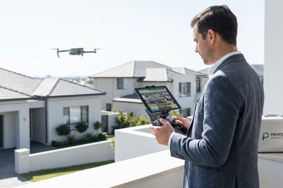
Drone technology is already shaping how property gets marketed, inspected, underwritten, and valued, even when buyers and sellers never notice it. If you work anywhere near real estate, you’re dealing with a market where aerial data now influences attention, risk, pricing, and transaction speed behind the scenes.
You’ll get more from this article if you read it as a practical guide to where drones are changing the property business right now. You’re going to see where they help listings win clicks, where they tighten inspections and insurance decisions, where they affect valuation workflows, and where legal compliance can make or break the value of using them at all.
What Is Driving Drone Adoption In Real Estate?
You’re seeing drones spread across property because they solve a plain business problem: they capture more usable information in less time. A ground-level photo can show the front elevation. A drone can show the roof, tree coverage, lot shape, nearby roads, neighboring structures, water access, slope, setbacks, and outdoor assets in a single media package.
That matters because property decisions are rarely based on a kitchen photo alone. Buyers want context. Lenders want documentation. Property managers want repeatable records. Insurance carriers want visual evidence. Once one tool starts serving all of those groups at the same time, adoption stops looking flashy and starts looking inevitable.
You should also pay attention to how drones fit modern buyer behavior. Most shoppers start on mobile devices, they scroll quickly, and they make snap judgments about whether a property feels complete, transparent, and worth a showing. Aerial visuals reduce uncertainty early. That reduction in uncertainty is where drones earn their place.
There’s another reason adoption keeps expanding: drones are no longer treated only as a luxury marketing add-on. They’re becoming operational infrastructure. When a tool moves from “nice extra” to “standard workflow input,” it starts dominating quietly. That’s what’s happening here.
How Are Drones Changing Property Listings?
If you market property, drones let you present what ground photography often misses. You can show lot depth, driveway access, detached structures, roof condition, outdoor entertaining areas, solar panels, fencing, tree lines, and the relationship between the home and the neighborhood around it. That changes how buyers interpret value before they ever book a tour.
This is especially useful when the property’s appeal depends on location or land features. Waterfront homes, rural parcels, mountain properties, corner lots, equestrian estates, large suburban homes, and properties near parks or trails all benefit when you can show spatial context instead of forcing buyers to guess. When buyers can see the full site, weak assumptions shrink.
Platforms are reinforcing this shift. Zillow has pushed drone-based listing features through SkyTour tied to its Showcase offering, which signals that aerial media is being packaged into the listing experience rather than treated as a fringe upgrade. Once listing platforms build drone content into premium presentation tools, agents start viewing aerial capture less as a creative option and more as a market expectation.
You should think about drone media as a credibility signal. A listing with complete exterior context feels more transparent. Buyers don’t like surprises, and neither do their agents. When your listing answers obvious exterior questions up front, you create cleaner interest. Cleaner interest leads to better showings, fewer wasted visits, and a tighter path to serious offers.
There’s also a competitive issue you can’t ignore. If comparable listings in your area use aerial photos, video, and immersive media, your standard ground-photo package starts to look thin. Buyers may not say, “This listing lost me because it lacked drone footage.” They’ll just keep scrolling. That’s the kind of market shift that looks quiet right up until it cuts your conversion rate.
Do Drone Photos Help Homes Sell Faster?
You should be careful with bold claims here. Drone media does not guarantee a faster sale or a higher sale price in every neighborhood, price bracket, or inventory cycle. Real estate never works that cleanly. What drones do give you is denser information, stronger visual storytelling, and a fuller picture of the property, and those benefits can move a listing forward faster when paired with solid pricing and presentation.
Vendor-side reporting in real estate media keeps pointing in the same direction: listings using richer media packages, especially combinations of video, aerial content, and three-dimensional tours, tend to generate stronger engagement. That doesn’t prove direct causation in every case, but it does tell you where buyer attention is going. Attention still drives the early part of the sales funnel.
If you want the practical view, think about what slows a listing down. Buyers hesitate when the lot is unclear, the roofline is hidden, the home’s proximity to busy roads is uncertain, or the backyard turns out to be smaller than expected. Drone visuals answer those questions earlier. Early answers produce better-qualified inquiries.
You also get a speed advantage during agent-to-agent communication. A buyer’s agent can review aerial imagery and decide faster whether the property fits the client’s needs. Less guesswork means fewer low-quality showings. Fewer low-quality showings mean your calendar gets filled with people who are closer to writing, not just browsing.
So if you’re asking whether drones “sell homes,” the better business answer is this: drones reduce friction in the attention and evaluation stages. That’s often enough to shorten time-to-action. In many markets, that matters more than chasing a neat headline about price premiums.
How Are Drones Being Used For Inspections And Property Operations?
This is where drone technology starts affecting the property business far beyond listing photos. Inspections are one of the clearest use cases because roofs, gutters, flashing, upper elevations, storm damage, and exterior wear can be documented without putting someone on a ladder or walking every roof surface. That lowers labor strain and reduces exposure to avoidable risk.
If you manage rental homes, commercial sites, community associations, or scattered-site portfolios, drone capture helps you build repeatable inspection records. You can document conditions over time, compare seasonal wear, flag maintenance issues earlier, and create a stronger visual paper trail for contractors, owners, and insurers. Repeatable visual records are useful during budgeting, disputes, and repair planning.
Drone-based roof inspections are also being priced in a way that makes them easier to slot into ordinary operations. Current market-facing pricing guides commonly place drone roof inspection costs in the low hundreds per roof, often around the range many managers can justify for routine checks or post-storm review. That makes drone use practical, not exotic.
You should pay attention to what happens after the images are captured. Drone data is easy to share across stakeholders. A property manager can send the roof images to a contractor. The contractor can scope repairs faster. The owner can approve work with fewer site visits. A broker can use the documentation during negotiations. One flight ends up serving several decisions.
That’s why drones are taking ground in property operations. They don’t just collect footage. They compress time between issue discovery and action. In real estate, speed has value when it helps you preserve income, avoid damage escalation, and move repair approvals without weeks of delay.
How Are Insurers Using Drones And Aerial Imaging?
If you want to understand where drones quietly dominate the property game, look at insurance. Carriers and their vendors are using aerial imagery, including drone, aircraft, and satellite-based views, to assess roof condition, exterior maintenance, tree exposure, debris, and other property signals tied to underwriting and renewal decisions. That means your home can be evaluated from above without a traditional on-site visit.
This changes the power balance in ways many property owners don’t expect. A homeowner may think coverage decisions hinge on claims history, local weather exposure, and basic property details. Those still matter. Yet aerial imagery now feeds insurers a visual layer of property condition data that can influence whether coverage is renewed, repriced, or questioned.
Consumer-facing reporting has highlighted that some homeowners have faced nonrenewal concerns or premium-related issues after insurers reviewed aerial images that appeared to show roof wear or property maintenance problems. The tension is easy to understand. Carriers gain speed and scale from remote review. Homeowners worry about image quality, outdated capture, and cosmetic conditions being treated as material defects.
Regulators have started stepping in. State-level guidance in places like Alabama, Massachusetts, and Rhode Island has pushed back against overreliance on aerial imagery for adverse underwriting actions, especially when the issue appears cosmetic or when one image is being treated as conclusive proof. That tells you the issue is no longer theoretical. It’s active enough to trigger formal regulatory attention.
You should connect this to the broader property market. Insurance affects affordability, and affordability affects deals. If aerial review leads to a premium increase, a repair demand, or a nonrenewal notice, the property transaction can tighten quickly. Escrow costs shift. Buyer comfort drops. Closing risk rises. In that sense, drone-enabled insurance review influences the property market even when it never shows up in the listing.
Are Drones Changing Appraisals And Valuation Workflows?
You’re not looking at a world where drones replace every appraiser or rewrite valuation math overnight. What you are seeing is a steady move toward standardized property data collection, more photo-based collateral review, and faster intake of condition-related evidence. Drones fit neatly into that shift because they capture exterior details efficiently and consistently.
Fannie Mae has been vocal about pushing more data-driven collateral valuation workflows, including property data collection models that can provide earlier value certainty and lower costs for some consumers compared with a traditional appraisal path. The larger point for you is not whether every file uses a drone. It’s that lenders and valuation systems now reward cleaner, faster, more standardized property data.
Drones help at the edges where property condition, site features, access, or external improvements matter. They can document outbuildings, lot usage, roof materials, exterior wear, drainage patterns, and site relationships that are harder to convey through limited ground images. That doesn’t produce value by itself, but it does sharpen the data going into a collateral decision.
You should also notice how this affects transaction timing. When stakeholders can gather and move property evidence faster, they reduce back-and-forth. Reduced back-and-forth can speed underwriting, reduce repeat visits, and limit delays tied to missing visual documentation. Time saved in the lending chain often matters more than people admit.
This is another quiet shift. Buyers and sellers often focus on the final number. The real operational change is happening upstream, where better exterior documentation supports cleaner valuation workflows. Drones don’t need center stage to influence the deal. They just need to make the file move faster and with fewer disputes.
What Legal Rules Apply To Commercial Drone Use In Real Estate?
If a drone flight is tied to business activity in U.S. real estate, you need to treat compliance as non-negotiable. Commercial operators generally need a Federal Aviation Administration, or FAA, Part 107 Remote Pilot Certificate to conduct paid drone work lawfully. If you hire someone for listing media, inspection work, or property-related aerial capture, you should verify that certification instead of assuming the camera operator is covered.
You also need to understand Remote Identification, often called Remote ID. This is the Federal Aviation Administration system that requires most registered drones to broadcast identification and location information during operation. At this point, commercial drone work is expected to be Remote ID compliant unless it falls into a limited exception. In ordinary real estate workflows, you should treat it as standard operating procedure.
Airspace rules matter too. You can’t assume a property is flyable just because the owner says yes. Controlled airspace, nearby airports, temporary restrictions, and local conditions can all affect whether a flight is allowed or whether prior authorization is needed. A legal operator plans the flight before showing up with batteries and a shot list.
Privacy and trespass concerns also deserve your attention. Even when a flight is technically legal under aviation rules, poor judgment around neighboring properties can trigger complaints, damage your reputation, or invite legal friction. Smart operators build clear flight plans, get written approvals where needed, and avoid casual behavior that makes nearby owners feel watched.
If you’re an agent, investor, broker, inspector, or property manager, the practical lesson is simple: don’t cut corners. One non-compliant flight can do more damage than a weak photo package ever would. The market rewards speed, but it punishes sloppy execution. You want drone work that protects the deal, not drone work that creates a new problem.
What Privacy Concerns Are Property Owners Raising?
Privacy concerns around drones in property are less about abstract fear and more about control. Owners want to know who captured the imagery, why it was collected, when it was taken, and how it will be used. Those are reasonable questions, especially when insurance, underwriting, property disputes, or neighborhood tensions enter the picture.
The sharpest concern usually appears when aerial imagery affects a decision before the owner knows the review happened. That’s why insurer use of aerial inspection has become such a flashpoint. Owners may accept that exterior property conditions matter, yet still object when blurry, dated, or incomplete images are treated as reliable evidence.
You should also factor in perception. Real estate professionals often see drones as efficient tools. Homeowners may see them as surveillance devices hovering over private space. If you ignore that emotional reality, you create resistance where you could have built trust. A short explanation about purpose, timing, and boundaries can prevent more friction than you’d expect.
Transparency does real work here. If you’re using drones for inspections, marketing, or due diligence, communicate the use plainly. If aerial imagery affects a repair request, underwriting concern, or negotiation point, identify what was seen and allow room for review. When owners feel shut out of the process, disputes get louder and harder to resolve.
This issue isn’t going away. As aerial imagery gets easier to collect and process, property owners will keep demanding clearer notice and fairer review. The professionals who handle that well will stand out. The ones who treat privacy concerns as noise will keep walking into avoidable conflict.
Why Does Drone Tech Matter To Agents, Investors, And Homeowners Differently?
You shouldn’t talk about drones as if every stakeholder uses them for the same reason. Agents care about listing performance, visual differentiation, and better buyer pre-qualification. Investors care about due diligence, site risk, capex planning, and faster inspection workflows. Homeowners care about privacy, insurance consequences, property condition, and how exterior evidence might be used against or for them.
For agents, drone media strengthens the presentation of land, amenities, and neighborhood placement. It helps win listings, support premium marketing packages, and make online presentation feel more complete. In markets where inventory quality varies sharply, that added clarity can help a property avoid getting buried in search fatigue.
For investors and operators, drones are less about aesthetics and more about operational discipline. Aerial inspection records can tighten acquisition review, support maintenance schedules, confirm contractor performance, and surface issues across a portfolio without sending teams onto every roof. That’s a measurable business function, not a creative extra.
For homeowners, the issue is more personal. Drones can help market a property well and support maintenance documentation after storms or before sale. Yet they can also become part of underwriting or claims review in ways that feel one-sided if communication is poor. That’s why homeowner sentiment around drone use can swing from appreciation to suspicion fast.
If you understand those differing incentives, you’ll use drone technology more effectively. The same aerial image can be marketing material, maintenance evidence, underwriting input, and negotiation leverage depending on who’s looking at it. That multi-use character is exactly why drones are becoming so embedded in the property business.
What Does Quiet Dominance Actually Look Like In The Property Game?
Quiet dominance does not mean drones replace every camera, inspector, appraiser, or property manager. It means they become normal enough that they influence outcomes without attracting much attention. You stop debating whether to use them and start building your workflow around what they reveal.
You can see this in listing media where aerial visuals are moving into platform-supported packages. You can see it in inspections where drones reduce risk and improve documentation. You can see it in insurance where remote imagery can affect renewal decisions. You can see it in valuation workflows where faster, cleaner property data helps files move.
The real story is not that drones are flashy. The real story is that they sit upstream from several decisions that control property value and deal flow. Attention, risk assessment, maintenance planning, underwriting, and transaction speed all benefit from better exterior data. Drones supply that data cheaply enough and fast enough to matter at scale.
You don’t need every buyer to notice a drone flight for the tool to dominate the market. You just need agents to rely on aerial media, insurers to review rooftops remotely, managers to standardize inspections, and lenders to reward cleaner documentation. Once that happens, drone technology stops being a niche gadget and starts acting like background infrastructure for modern property work.
How Are Drones Affecting Real Estate Right Now?
- Drones improve listing media with better lot, roof, view, & neighborhood context.
- Drones speed inspections, especially roof and exterior condition checks.
- Drones support insurance, underwriting, and property data collection workflows.
- Commercial use requires Federal Aviation Administration compliance, including Part 107 rules.
Use The Aerial Edge Before The Market Treats It As Basic
You’re already in a property market where drones influence visibility, documentation, insurance review, and deal flow, whether or not that influence is obvious on the surface. The advantage now comes from understanding where aerial data changes decisions and where it simply adds noise. If you market listings, manage assets, evaluate acquisitions, or protect a home’s insurability, you need to treat drone technology as part of normal property strategy, not as a novelty. The professionals who use it with clear purpose, legal discipline, and better communication will keep pulling ahead. The rest will wake up to a market that has already moved.

Chrysilios Chrysiliou is a commercial real estate executive at RDPH Properties, Inc. with a diverse background in aviation and entrepreneurship. A former Greek Air Force Academy graduate, flight instructor, and flight school co-owner, he now leverages decades of strategic leadership to identify and develop high-value real estate opportunities.